Hastain, Missouri
From Wikipedia, the free encyclopedia
Hastain, Missouri | |
|---|---|
 Hastain  Hastain | |
| Coordinates: 38°12′07″N 93°10′35″W / 38.20194°N 93.17639°W | |
| Country | United States |
| State | Missouri |
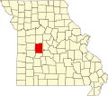
| County | Benton |
| Elevation | 686 ft (209 m) |
| Time zone | UTC-6 (Central (CST)) |
| • Summer (DST) | UTC-5 (CDT) |
| Area code | 660 |
| GNIS feature ID | 740911[1] |
Hastain is an unincorporated community in Benton County, Missouri, United States. Hastain is located on Supplemental Route V, 11.5 miles (18.5 km) east-southeast of Warsaw.[2]
A post office called Hastain was established in 1884, and remained in operation until 1951.[3] The community was named after the local Hastain family.[4]