Blacktail, North Dakota
From Wikipedia, the free encyclopedia
CountryUnited States
Elevation2,090 ft (640 m)
Blacktail, North Dakota | |
|---|---|
  Blacktail  Blacktail | |
| Coordinates: 48°25′58″N 103°44′24″W / 48.43278°N 103.74000°W | |
| Country | United States |
| State | North Dakota |
| County | Williams |
| Township | Blacktail |
| Area | |
• Total | 0.57 sq mi (1.47 km2) |
| • Land | 0.33 sq mi (0.86 km2) |
| • Water | 0.24 sq mi (0.61 km2) |
| Elevation | 2,090 ft (640 m) |
| Population (2020) | |
• Total | 61 |
| • Density | 183.9/sq mi (71.02/km2) |
| Time zone | UTC-6 (Central (CST)) |
| • Summer (DST) | UTC-5 (CDT) |
| ZIP Code | 58801 (Williston) |
| Area code | 701 |
| FIPS code | 38-07456 |
| GNIS feature ID | 2805286[2] |
Blacktail is an unincorporated community and census-designated place (CDP) built around Blacktail Lake in Williams County, North Dakota, United States. It was first listed as a CDP prior to the 2020 census.[2] As of the 2020 census, Blacktail had a population of 61.[3]
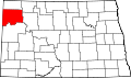
The CDP is in northwestern Williams County, in the north-central part of Blacktail Township. It consists of residences built on the shore of Blacktail Lake, a small reservoir built on Blacktail Creek, a southeast-flowing tributary of the Little Muddy River, which flows south to the Missouri River at Williston, 25 miles (40 km) south of Blacktail.