Bolivar, Mississippi
From Wikipedia, the free encyclopedia
 United States
Bolivar, Mississippi | |
|---|---|
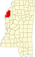
  Bolivar Location within the U.S. state of Mississippi | |
| Coordinates: 33°39′38″N 91°03′07″W / 33.66056°N 91.05194°W | |
| Country | United States |
| State |  Mississippi Mississippi |
| County | Bolivar |
| Founded | December 12, 1835 |
| Named after | Simón Bolívar |
| Area | |
• Total | 0.25 sq mi (0.65 km2) |
| • Land | 0.25 sq mi (0.65 km2) |
| • Water | 0 sq mi (0.00 km2) |
| Elevation | 141 ft (43 m) |
| Population (2020) | |
• Total | 39 |
| • Density | 156.2/sq mi (60.32/km2) |
| Time zone | UTC-6 (Central (CST)) |
| • Summer (DST) | UTC-5 (CDT) |
| ZIP code | 38725 |
| GNIS feature ID | 2812715[2] |
Bolivar is a census-designated place and unincorporated community in Bolivar County, Mississippi, United States.
Bolivar was once the county seat, and Bolivar Landing was its port on the Mississippi River. Now permanently cut off from the river, Bolivar is a quiescent residential hamlet, while Bolivar Landing, immediately north and across the immense Mississippi Levee, is a cottage community on Lake Whittington. It was first named as a CDP in the 2020 Census which listed a population of 39.[3]
Founded on December 12, 1835, a U.S. post office operated under the name Bolivar until 1908.[4]
When Bolivar County was established on December 12, 1835, the first county seat was located at Bolivar. William Vick sold 5 acres (2.0 ha) of land to the county for $800, and it was then named Bolivar. The land was surveyed by B.M. Hines, who laid out the courthouse square, with town lots around it which were advertised for sale. An order was passed by the Board of Police (later called "supervisors") in 1840 to build a one-room courthouse at a cost of $595.
In 1844, the Board of Police ordered that the county seat be moved to a location north of present-day Beulah. Soon after, the county seat was moved to Prentiss, where a courthouse was erected.[5][6] After the near-destruction of Prentiss during the Civil War, the courthouse was placed on a flat-boat and carried down the river to Bolivar Landing.[7][8]
Trusten Polk, a former U.S. Senator and Governor of Missouri, was captured by Union forces at Bolivar Landing in 1863, along with his wife and two daughters.[9] In 1864, Union forces carried away cargo from Bolivar Landing, and set fire to several houses.[10] Also in 1864, Confederate soldiers burned the USS Collier near Bolivar Landing, though the ship was not destroyed.[11]
In 1874, high waters on the Mississippi River broke a levee at Bolivar Landing, forming a crevasse 1,900 ft (580 m) wide.[12]
The U.S. Army Corps of Engineers completed the Caulk Island Cutoff in 1937, which diverted the course of the Mississippi River to enable a more direct route for shipping. This diversion removed Bolivar Landing from contiguous access to the Mississippi River (except for a small channel for recreational boats), and created Lake Whittington, an oxbow lake.[13]