Hushpuckena, Mississippi
From Wikipedia, the free encyclopedia
Hushpuckena, Mississippi | |
|---|---|
 | |
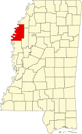
  Hushpuckena, Mississippi  Hushpuckena, Mississippi | |
| Coordinates: 34°00′17″N 90°45′11″W / 34.00472°N 90.75306°W | |
| Country | United States |
| State | Mississippi |
| County | Bolivar |
| Elevation | 128 ft (39 m) |
| Time zone | UTC-6 (Central (CST)) |
| • Summer (DST) | UTC-5 (CDT) |
| ZIP code | 38774 |
| Area code | 662 |
| GNIS feature ID | 671639[1] |
Hushpuckena is an unincorporated community located in Bolivar County, Mississippi, United States along U.S. Route 61. Hushpuckena is located approximately 3 miles (4.8 km) south of Duncan and approximately 4 miles (6.4 km) north of Shelby. Hushpuckena is located on the former Yazoo and Mississippi Valley Railroad.[2] Hushpuckena was named after the Hushpuckena River.[3] Hushpuckena is a name derived from the Choctaw language purported to mean "sunflowers are abundant".[4]
A post office operated under the name Hushpuckena from 1885 to 1968.[5]