Bronckhorst
From Wikipedia, the free encyclopedia
Bronckhorst | |
|---|---|
 | |
 Flag .svg) Coat of arms | |
.svg) Location in Gelderland | |
| Coordinates: 52°3′N 6°18′E / 52.050°N 6.300°E | |
| Country | Netherlands |
| Province | Gelderland |
| Established | 1 January 2005[1] |
| Government | |
| • Body | Municipal council |
| • Mayor | Marianne Besselink (PvdA) |
| Area | |
• Total | 286.42 km2 (110.59 sq mi) |
| • Land | 283.50 km2 (109.46 sq mi) |
| • Water | 2.92 km2 (1.13 sq mi) |
| Elevation | 13 m (43 ft) |
| Highest elevation | 43 m (141 ft) |
| Population (January 2021)[6] | |
• Total | 36,087 |
| • Density | 127/km2 (330/sq mi) |
| Time zone | UTC+1 (CET) |
| • Summer (DST) | UTC+2 (CEST) |
| Postcode | Parts of 6900, 7000 and 7200 ranges |
| Area code | 0313, 0314, 0575 |
| Website | www |

Bronckhorst (pronounced [ˈbrɔŋkɦɔrst] ⓘ) is a municipality in Gelderland, the Netherlands. The municipality is the result of a merger of the former municipalities Hengelo, Hummelo en Keppel, Steenderen, Vorden and Zelhem, on 1 January 2005. The municipality is named after the medieval castle of the Bronckhorst family, who once ruled the area.
The seat of the municipality is Hengelo.
Keppel
|
Formerly in Hengelo: Formerly in Hummelo en Keppel: Formerly in Vorden: |
Formerly in Zelhem:
Formerly in Steenderen:
|
Keppel received city rights in 1404.
Gallery
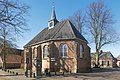 Bronkhorst, chapel
 Hengelo, church (de Remigiuskerk) in the street
 Laag Keppel, reformed church
 Halle, reformed church
 Baak, church: the Sint-Martinuskerk
 Steenderen, windmill: de Bronkhorster Molen
 Wittebrink, windmill: de Wittebrinkse Molen
 between Olburgen and Doesburg, the Zwarte Schaar near inlaatwerk 4028


