
Cần Thơ
Municipality of Vietnam
From Wikipedia, the free encyclopedia
Cần Thơ (Vietnamese pronunciation: [kə̀n tʰə̄ː] ⓘ) is the third largest municipality in Vietnam and is in the Mekong Delta region.[7] It is noted for its floating markets, Bánh tráng-making village, and rural canals.[7] Cần Thơ has a population of around 4,199,824 as of 2024.[8]
2.jpg)
Cần Thơ
Can Tho | |
|---|---|
| City of Cần Thơ Thành phố Cần Thơ | |
 Seal | |
 | |
 Interactive map of Cần Thơ | |
| Coordinates: 10°02′N 105°47′E | |
| Country | |
| Region | Mekong Delta |
| Founded | 1739 |
| Seat | Ninh Kiều |
| Subdivision | 31 wards, 72 communes |
| Government | |
| • Type | Municipality (Class-1) |
| • Body | Cần Thơ People's Council |
| • Secretary of the Party | Đỗ Thanh Bình |
| • Chairman of People's Council | Đồng Văn Thanh |
| • Chairman of People's Committee | Trương Cảnh Tuyên |
| Area | |
• Total | 6,360.83 km2 (2,455.93 sq mi) |
| Population | |
• Total | 4,199,824 |
| • Density | 660/km2 (1,700/sq mi) |
| Ethnic groups | |
| • Vietnamese[4] | 97.47% |
| • Khmer | 1.59% |
| • Hoa | 0.88% |
| • Others | 0.06% |
| GDP (PPP, constant 2025 values) | |
| • Year | 2025 |
| • Total | $11,05 million billion[5] |
| • Per capita | $3,801.49 |
| Time zone | UTC+07:00 (ICT) |
| Postal code | 94xxx |
| Area codes | 292 |
| ISO 3166 code | VN-CT |
| License plate | 65 |
| HDI (2020) | (16th) |
| Climate | Aw |
| International airports | Can Tho International Airport |
| Website | cantho.gov.vn |


On June 12, 2025, the National Assembly passed Resolution No. 202/2025/QH15, which took effect the same day, merging Hậu Giang Province and Sóc Trăng Province into Cần Thơ municipality.[9] Ninh Kiều, which has the Ninh Kiều port, is the former central district and the most populated of the former districts.[10]
Geography
Cần Thơ city has the following geographical location:
- To the southwest, it borders Cà Mau province.
- To the west and north, it borders An Giang province.
- To the east, it borders Vĩnh Long province.
- To the northeast, it borders Đồng Tháp province.
- To the south, it borders the East Sea.
Tourism

Can Tho is known for attractions such as Cai Rang Floating Market, Ninh Kieu Wharf, and Truc Lam Phuong Nam Zen Monastery. Visitors from Ho Chi Minh City can follow National Highway 1A to Can Tho City. The travel distance is about 170 kilometers, taking 3 to 4 hours during the day.[11] Cần Thơ (shared with Hậu Giang) has floating markets, including the Cai Rang floating market, where people sell and buy things on the river, and has bird gardens and the port of Ninh Kiều. The city offers a range of tropical fruits such as pomelo, longan, jackfruit, mango, guava, banana, rambutan, mangosteen, dragon fruit and durian. The Cần Thơ City Museum has exhibits on the city's history.[12]
From Phú Quốc island, tourists can use the ferry, passenger bus or taxi to transfer to Cần Thơ.[13]
Attractions:
- Cần Thơ Bridge
- Thiền viện Trúc Lâm Phương Nam (Buddhist temple)
- Nam Nhã Pagoda
- Bình Thủy Temple
- The historic Bình Thủy house (nhà cổ Bình Thủy, 1870): a mix of French and Asian architecture
- Ninh Kiều Quay
- Cần Thơ pedestrian bridge
- Cái Răng Floating Market & Phong Điền Floating Market
- Bằng Lăng Stork Sanctuary (Thốt Nốt district)
- Canal tour
- Cần Thơ Cathedral
- Ông Chinese Pagoda
- Pitu Khôsa Răngsây Khmer Pagoda
- Quang Đức Pagoda
- Lưu Hữu Phước Park[14]
- Phật Học Pagoda[15]
- Mỹ Khánh tourist village
- Cần Thơ seminary
- Sơn Islet
- Cần Thơ Museum
- Hùng Kings Temple (Cần Thơ)
- Tây Đô Night Market

Education
Academic institutions in the municipality are Cần Thơ University, Cần Thơ Department of Education and Training, Cần Thơ University of Medicine and Pharmacy, Tây Đô University, Nam Cần Thơ University, Cần Thơ College, College of Foreign Economic Relations – Cần Thơ Branch, Medical College, Singapore International School at Can Tho,[16] and Cần Thơ Technical Economic College.[17]
Media
Vietnam Television has a studio located in the Ninh Kiều district of the city which broadcast local news and television programmes for the Mekong Delta region of Vietnam that broadcast on the channel VTV Cần Thơ and for VTV9.[18]
Transport
The municipality is served by Cần Thơ International Airport which is located 9 km (6 mi) north west of the municipal centre. The airport provides direct routes to other parts of Vietnam such as Hanoi, Da Nang, Hai Phong, Ha Long, Phu Quoc and Con Dao which are operated by Vietnam Airlines, VietJet Air and Bamboo Airways.[19]
Climate
Under the Köppen climate classification, Cần Thơ has a tropical wet and dry climate (Aw). Cần Thơ's climate features two seasons: rainy (from May to November) and dry (from December to April). Average annual humidity is 83%, rainfall 1,800 mm (71 in) and temperature 27 °C (81 °F).
| Climate data for Cần Thơ | |||||||||||||
|---|---|---|---|---|---|---|---|---|---|---|---|---|---|
| Month | Jan | Feb | Mar | Apr | May | Jun | Jul | Aug | Sep | Oct | Nov | Dec | Year |
| Record high °C (°F) | 34.2 (93.6) |
35.2 (95.4) |
38.5 (101.3) |
40.0 (104.0) |
38.3 (100.9) |
37.3 (99.1) |
36.8 (98.2) |
35.5 (95.9) |
35.2 (95.4) |
35.8 (96.4) |
34.7 (94.5) |
34.0 (93.2) |
40.0 (104.0) |
| Mean daily maximum °C (°F) | 30.2 (86.4) |
31.2 (88.2) |
32.7 (90.9) |
33.9 (93.0) |
33.2 (91.8) |
32.0 (89.6) |
31.4 (88.5) |
31.2 (88.2) |
31.1 (88.0) |
31.0 (87.8) |
30.7 (87.3) |
29.7 (85.5) |
31.5 (88.7) |
| Daily mean °C (°F) | 25.4 (77.7) |
26.1 (79.0) |
27.3 (81.1) |
28.5 (83.3) |
28.0 (82.4) |
27.3 (81.1) |
26.9 (80.4) |
26.8 (80.2) |
26.8 (80.2) |
26.9 (80.4) |
26.9 (80.4) |
25.7 (78.3) |
26.9 (80.4) |
| Mean daily minimum °C (°F) | 22.3 (72.1) |
22.7 (72.9) |
23.9 (75.0) |
25.0 (77.0) |
25.2 (77.4) |
24.6 (76.3) |
24.3 (75.7) |
24.4 (75.9) |
24.4 (75.9) |
24.4 (75.9) |
24.3 (75.7) |
23.0 (73.4) |
24.1 (75.4) |
| Record low °C (°F) | 14.8 (58.6) |
17.3 (63.1) |
17.5 (63.5) |
19.2 (66.6) |
18.7 (65.7) |
19.0 (66.2) |
19.5 (67.1) |
19.7 (67.5) |
17.8 (64.0) |
18.7 (65.7) |
17.5 (63.5) |
16.5 (61.7) |
14.8 (58.6) |
| Average rainfall mm (inches) | 10.0 (0.39) |
3.8 (0.15) |
15.4 (0.61) |
41.8 (1.65) |
223.0 (8.78) |
309.7 (12.19) |
336.0 (13.23) |
337.9 (13.30) |
451.4 (17.77) |
300.9 (11.85) |
137.1 (5.40) |
41.5 (1.63) |
1,967.5 (77.46) |
| Average rainy days | 2.0 | 0.8 | 1.8 | 5.6 | 16.4 | 19.9 | 21.5 | 21.6 | 22.1 | 21.8 | 13.6 | 6.5 | 153.3 |
| Average relative humidity (%) | 80.9 | 79.4 | 77.9 | 78.2 | 83.7 | 86.0 | 86.2 | 87.0 | 87.1 | 86.2 | 84.3 | 82.1 | 83.4 |
| Mean monthly sunshine hours | 244.9 | 243.0 | 280.8 | 258.8 | 210.3 | 175.8 | 183.2 | 179.5 | 165.9 | 178.0 | 192.7 | 215.3 | 2,524.3 |
| Source: Vietnam Institute for Building Science and Technology[20] | |||||||||||||
Twin towns – sister cities
Gallery


 Cần Thơ market
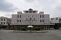 Museum of People's Armed Forces


