Castle Peak (California)
Mountain in California's Sierra Nevada
From Wikipedia, the free encyclopedia
Castle Peak is a mountain in California's Sierra Nevada near I-80, Donner Pass, and the Nevada border. It is in the Tahoe National Forest[2] not far off the Pacific Crest Trail, and adjacent to Castle Pass. It was originally named Mount Stanford, after Leland Stanford, by the Whitney Survey of 1860–1874. The peak takes its name from its conical shape.[4]

| Castle Peak | |
|---|---|
Castle Peak from Andesite Peak | |
| Highest point | |
| Elevation | 9,109 ft (2,776 m) NAVD 88[1] |
| Prominence | 1,343 ft (409 m)[2] |
| Listing | Sierra Peaks Section[3] |
| Coordinates | 39°21′56″N 120°20′57″W[1] |
| Geography | |
  Castle Peak Location in California  Castle Peak Castle Peak (the United States) | |
| Location | Nevada County, California, U.S. |
| Parent range | Sierra Nevada |
| Topo map | USGS Norden |
| Climbing | |
| Easiest route | Exposed scramble (class 3)[3] |
On February 17, 2026, Castle Peak was the site of a deadly avalanche in which eight skiers were killed.[5]
Climate
According to the Köppen climate classification system, Castle Peak is located in an alpine climate zone.[6] Most weather fronts originate in the Pacific Ocean and travel east toward the Sierra Nevada mountains. As fronts approach, they are forced upward by the peaks (orographic lift), causing them to drop their moisture in the form of rain or snowfall onto the range. Donner Pass averages 51.6 inches (1,310 mm) of precipitation per year,[7] and with an average of 411.5 inches (10.45 m) of snow per year, it is one of the snowiest places in the contiguous United States.[8]
Gallery
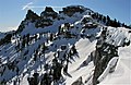 Castle Peak from the south ridge. The highest summit is on the left.
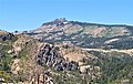 South-southeast aspect
 View of Castle Peak's summit, from terminus of the Castle Peak Summit Trail.
.jpg)

.JPG)
See also
- Sierra Nevada subalpine zone — habitat and forest surrounding peak.
.jpg)
