Centralia Township, Marion County, Illinois
From Wikipedia, the free encyclopedia
Centralia Township | |
|---|---|
 | |
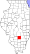
.svg) Location of Illinois in the United States | |
| Coordinates: 38°31′N 89°5′W / 38.517°N 89.083°W | |
| Country | United States |
| State | Illinois |
| County | Marion |
| Settled | November 4, 1873 |
| Area | |
• Total | 36.1 sq mi (93 km2) |
| • Land | 35.02 sq mi (90.7 km2) |
| • Water | 1.08 sq mi (2.8 km2) |
| Elevation | 515 ft (157 m) |
| Population (2010) | |
| 14,547 | |
| • Density | 429.5/sq mi (165.8/km2) |
| Time zone | UTC-6 (CST) |
| • Summer (DST) | UTC-5 (CDT) |
| FIPS code | 17-121-12177 |
Centralia Township is located in Marion County, Illinois. As of the 2010 census, its population was 15,042 and it contained 7,360 housing units.[2]
Centralia township (T1N R1E) is centered at 38°31'N 89°5'W (38.517, -89.087). The city of Centralia is located in the western part of the township. The township is traversed by U.S. Route 51 (north-south) and by State Route 161 (east-west). According to the 2010 census, the township has a total area of 36.1 square miles (93 km2), of which 35.02 square miles (90.7 km2) (or 97.01%) is land and 1.08 square miles (2.8 km2) (or 2.99%) is water.[2]