Clay Township, Atchison County, Missouri
From Wikipedia, the free encyclopedia
Clay Township | |
|---|---|
 | |
| Coordinates: 40°23′21″N 95°31′44″W / 40.3891576°N 95.528917°W | |
| Country |  United States United States |
| State |  Missouri Missouri |
| County | Atchison |
| Area | |
• Total | 42.03 sq mi (108.9 km2) |
| • Land | 42.01 sq mi (108.8 km2) |
| • Water | 0.02 sq mi (0.052 km2) 0.05% |
| Elevation | 984 ft (300 m) |
| Population | |
• Total | 1,710 |
| • Density | 40.7/sq mi (15.7/km2) |
| FIPS code | 29-00514284[1] |
| GNIS feature ID | 766233[2] |
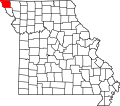
Clay Township is a township in Atchison County, Missouri, United States.[2] At the 2020 census, its population was 1710.[3]
Clay Township was organized on February 20, 1856 after being split from Clark Township and Polk Township.[4] It was named after Henry Clay of Kentucky.[5] The first mill in Atchison County was built in 1842 on Rock Creek in this township.[6]
Geography
Clay Township covers an area of 42.03 square miles (108.9 km2) and contains one incorporated settlement, Rock Port (the county seat). It contains seven cemeteries: Bush, County Home, Elmwood, Greenhill, Hunter, Millsap, and Smith.[7]
The largest stream in the township is Rock Creek, and a few smaller streams flow through as well: Boney Branch, Turkey Creek, and Volger Branch.
The former settlement of Union City was located in the center-west of the township on the foot of the Loess Bluffs three-miles east of Phelps City.[8]
.svg)