Nishnabotna, Missouri
From Wikipedia, the free encyclopedia
Nishnabotna, Missouri | |
|---|---|
Extinct community | |
 BNSF Railway and Route 111 at the site of Nishnabotna | |
  Nishnabotna | |
| Coordinates: 40°17′45″N 95°30′31″W / 40.29583°N 95.50861°W[1] | |
| Country |  United States United States |
| State |  Missouri Missouri |
| County | Atchison |
| Township | Clark |
| Elevation | 873 ft (266 m) |
| GNIS feature ID | 2587101[1] |
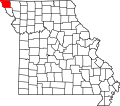
Nishnabotna is an extinct hamlet in southwestern Atchison County, in the U.S. state of Missouri.[1]
Nishnabotna was laid out in 1877 and named after the nearby Nishnabotna River,[3] and it was located on the Kansas City and Omaha Line[2] of the Chicago, Burlington, and Quincy Railroad.[4][5] An alternative name of the settlement was Nishne Station.[6] It was located 5.5 miles southeast of Langdon and 4.5 miles northeast of Corning along the railroad.[7] A post office called Nishnabotna was established in 1871 and remained in operation until 1953.[8] The population in 1915 was about 30.[4]