Cushing, Minnesota
From Wikipedia, the free encyclopedia
Cushing, Minnesota | |
|---|---|
 Cushing  Cushing | |
| Coordinates: 46°08′23″N 94°34′37″W / 46.13972°N 94.57694°W | |
| Country | United States |
| State | Minnesota |
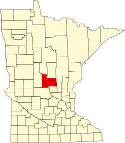
| County | Morrison |
| Township | Cushing |
| Elevation | 1,266 ft (386 m) |
| Time zone | UTC-6 (Central (CST)) |
| • Summer (DST) | UTC-5 (CDT) |
| ZIP code | 56443 |
| Area code | 320 / 218 |
| GNIS feature ID | 642566[1] |
Cushing is an unincorporated community in Cushing Township, Morrison County, Minnesota, United States. The community is along U.S. Highway 10 near Morrison County Road 5, Bear Road. Nearby places include Randall, Little Falls, and Motley.
The community is home to a post office, a park, a bar, and a church. The town hall for surrounding Cushing Township is in Cushing. The BNSF Railway passes through the community.
Cushing was platted in 1907.[2] According to Warren Upham, the community was probably named after Caleb Cushing, a politician from Massachusetts.[2]