Morrill, Minnesota
From Wikipedia, the free encyclopedia
Morrill, Minnesota | |
|---|---|
 Morrill  Morrill | |
| Coordinates: 45°50′20″N 93°58′11″W / 45.83889°N 93.96972°W | |
| Country | United States |
| State | Minnesota |
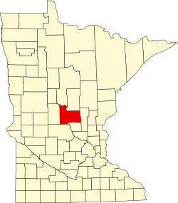
| County | Morrison |
| Township | Morrill |
| Elevation | 1,309 ft (399 m) |
| Time zone | UTC-6 (Central (CST)) |
| • Summer (DST) | UTC-5 (CDT) |
| ZIP code | 56364, 56338, and 56329 |
| Area code | 320 |
| GNIS feature ID | 648115[1] |
Morrill is an unincorporated community in Morrill Township, Morrison County, Minnesota, United States. The community is located near the junction of 330th Avenue and Morrison County Road 26, Nature Road. Nearby places include Pierz, Hillman, Little Rock, Ramey, and Foley.