Ebermannsdorf
From Wikipedia, the free encyclopedia
Ebermannsdorf | |
|---|---|
 Ebermannsdorf Castle | |
 Flag  Coat of arms | |
Location of Ebermannsdorf within Amberg-Sulzbach district 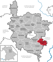 | |
 Ebermannsdorf  Ebermannsdorf | |
| Coordinates: 49°23′35″N 11°56′15″E / 49.39306°N 11.93750°E | |
| Country | Germany |
| State | Bavaria |
| Admin. region | Oberpfalz |
| District | Amberg-Sulzbach |
| Government | |
| • Mayor (2020–26) | Erich Meidinger[1] (CSU) |
| Area | |
• Total | 45.39 km2 (17.53 sq mi) |
| Elevation | 396 m (1,299 ft) |
| Population (2023-12-31)[2] | |
• Total | 2,363 |
| • Density | 52/km2 (130/sq mi) |
| Time zone | UTC+01:00 (CET) |
| • Summer (DST) | UTC+02:00 (CEST) |
| Postal codes | 92263 |
| Dialling codes | 09624 |
| Vehicle registration | AS |
| Website | www.Ebermannsdorf.de |
Ebermannsdorf is a municipality in the district of Amberg-Sulzbach in Bavaria in Germany.
Apart from Ebermannsdorf the municipality consists of the following villages:[3]
- Arling
- Au
- Breitenbrunn
- Diebis
- Frauenlohe
- Gleicheröd
- Herflucht
- Ipflheim
- Niederarling
- Pittersberg
- Schafhof
