Ursensollen
From Wikipedia, the free encyclopedia
Ursensollen | |
|---|---|
 Church of Saint Vitus | |
 Flag  Coat of arms | |
Location of Ursensollen within Amberg-Sulzbach district 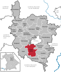 | |
 Ursensollen  Ursensollen | |
| Coordinates: 49°24′4″N 11°45′28″E / 49.40111°N 11.75778°E | |
| Country | Germany |
| State | Bavaria |
| Admin. region | Oberpfalz |
| District | Amberg-Sulzbach |
| Government | |
| • Mayor (2020–26) | Albert Geitner[1] |
| Area | |
• Total | 72.91 km2 (28.15 sq mi) |
| Elevation | 537 m (1,762 ft) |
| Population (2023-12-31)[2] | |
• Total | 3,843 |
| • Density | 53/km2 (140/sq mi) |
| Time zone | UTC+01:00 (CET) |
| • Summer (DST) | UTC+02:00 (CEST) |
| Postal codes | 92289 |
| Dialling codes | 09628 |
| Vehicle registration | AS |
| Website | www |
Ursensollen is a municipality in the district of Amberg-Sulzbach in Bavaria in Germany.
Ursensollen is in the region Upper Palatinate-North about 10 km to the west of Amberg.
Apart from Ursensollen the municipality consists of the following villages:[3]
- Bittenbrunn
- Darsberg
- Eglhofen
- Ehringsfeld
- Eigentshofen
- Erlheim
- Garsdorf
- Gunzelsdorf
- Haag
- Hausen
- Häuslöd
- Heimhof
- Heinzhof
- Hohenkemnath
- Inselsberg
- Kemnatheröd
- Kotzheim
- Littenschwang
- Oberhof
- Oberleinsiedl
- Ödallerzhof
- Ödgötzendorf
- Reinbrunn
- Richtheim
- Rückertshof
- Salleröd
- Sauheim
- Stockau
- Thonhausen
- Ullersberg
- Unterleinsiedl
- Ursensollen
- Wappersdorf
- Weiherzant
- Winkl
- Wollenzhofen
- Zant
