Elliott, South Carolina
From Wikipedia, the free encyclopedia
Elliott, South Carolina | |
|---|---|
 Buildeings in Elliott | |
  Elliott  Elliott | |
| Coordinates: 34°06′31″N 80°10′13″W / 34.10861°N 80.17028°W[1] | |
| Country | United States |
| State | South Carolina |
| County | Lee |
| Area | |
• Total | 1.86 sq mi (4.82 km2) |
| • Land | 1.85 sq mi (4.80 km2) |
| • Water | 0.0039 sq mi (0.01 km2) |
| Elevation | 171 ft (52 m) |
| Population | |
• Total | 370 |
| • Density | 199.6/sq mi (77.05/km2) |
| Time zone | UTC-5 (Eastern (EST)) |
| • Summer (DST) | UTC-4 (EDT) |
| ZIP code | 29046 |
| Area codes | 803, 839 |
| GNIS feature ID | 2812974[1] |
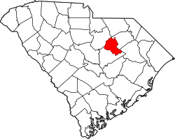
Elliott is an unincorporated community and census-designated place (CDP) in Lee County, South Carolina, United States.[1] It was first listed as a CDP in the 2020 census with a population of 370.[4]
The community is located at the junction of U.S. Route 401 and South Carolina Highway 527, 9 miles (14 km) south-southeast of Bishopville. Elliott has a post office with ZIP code 29046, which opened on March 20, 1888.[5][6]