Ferry Township, North Dakota
From Wikipedia, the free encyclopedia
Ferry Township, North Dakota | |
|---|---|
  Ferry Township | |
| Coordinates: 48°03′47″N 97°10′12″W / 48.06306°N 97.17000°W | |
| Country |  United States United States |
| State |  North Dakota North Dakota |
| County | Grand Forks |
| Area | |
• Total | 46.19 sq mi (119.62 km2) |
| • Land | 45.99 sq mi (119.12 km2) |
| • Water | 0.19 sq mi (0.49 km2) |
| Elevation | 823 ft (251 m) |
| Population | |
• Total | 345 |
| • Density | 7.50/sq mi (2.90/km2) |
| Time zone | UTC-6 (Central (CST)) |
| • Summer (DST) | UTC-5 (CDT) |
| ZIP codes | |
| Area code | 701 |
| FIPS code | 38-26020 |
| GNIS feature ID | 1036616[2] |
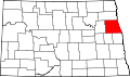
Ferry Township is a township in Grand Forks County, North Dakota, United States. The population was 345 at the 2020 census. The township borders Minnesota to its east.