Forest Grove, Minnesota
From Wikipedia, the free encyclopedia
Forest Grove | |
|---|---|
 Forest Grove  Forest Grove | |
| Coordinates: 47°58′36″N 94°13′53″W / 47.97667°N 94.23139°W | |
| Country | United States |
| State | Minnesota |
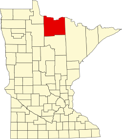
| County | Koochiching |
| Elevation | 1,365 ft (416 m) |
| Time zone | UTC-6 (Central (CST)) |
| • Summer (DST) | UTC-5 (CDT) |
| ZIP code | 56660 |
| Area code | 218 |
| GNIS feature ID | 656295[1] |
Forest Grove is an unincorporated community in Koochiching County, Minnesota, United States; located within the Pine Island State Forest. The community is located north of Mizpah and west of Gemmell, along Koochiching County Road 17 (CR 17).
U.S. Highway 71 and County Road 36 are also nearby. The center of Forest Grove is generally considered at the intersection of County Roads 17, 58, and 150.
Forest Grove is located within ZIP code 56660, based in Mizpah.