Silverdale, Minnesota
From Wikipedia, the free encyclopedia
Silverdale | |
|---|---|
 Silverdale  Silverdale | |
| Coordinates: 47°59′10″N 93°06′35″W / 47.98611°N 93.10972°W | |
| Country | United States |
| State | Minnesota |
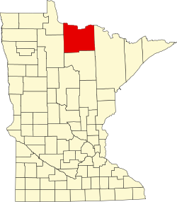
| County | Koochiching |
| Elevation | 1,312 ft (400 m) |
| Time zone | UTC-6 (Central (CST)) |
| • Summer (DST) | UTC-5 (CDT) |
| ZIP code | 55771 |
| Area code | 218 |
| GNIS feature ID | 654944[1] |
Silverdale is an unincorporated community in Koochiching County, Minnesota, United States; located in the southeast corner of the county.
The community is located between Orr and Togo at the junction of State Highway 65 (MN 65) and County Road 74.
Silverdale is located within ZIP code 55771 based in Orr. The boundary line between Koochiching and Saint Louis counties is nearby.
The Little Fork River flows through the area. The Willow River, a tributary of the Little Fork River, is also nearby.