Foul Rift, New Jersey
From Wikipedia, the free encyclopedia
Country United States
 United States
Elevation239 ft (73 m)
Foul Rift, New Jersey | |
|---|---|
 View of Martins Creek Power Station and the Delaware River from the south end of Foul Rift | |
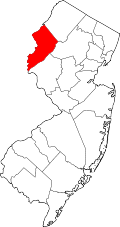
  Foul Rift, New Jersey Location of Foul Rift in Warren County Inset: Location of county within the state of New Jersey  Foul Rift, New Jersey Foul Rift, New Jersey (New Jersey)  Foul Rift, New Jersey Foul Rift, New Jersey (the United States) | |
| Coordinates: 40°48′08″N 75°05′52″W / 40.80222°N 75.09778°W | |
| Country | United States |
| State |  New Jersey New Jersey |
| County | Warren |
| Township | White |
| Elevation | 239 ft (73 m) |
| Time zone | UTC−05:00 (Eastern (EST)) |
| • Summer (DST) | UTC−04:00 (EDT) |
| GNIS feature ID | 876430[1] |
Foul Rift is an unincorporated community and one-time ghost town located within White Township, in Warren County, in the U.S. state of New Jersey.[1][2] Foul Rift had been a cottage community located on the east bank of the Delaware River, 2 mi (3.2 km) south of Belvidere.