Harmony (CDP), New Jersey
From Wikipedia, the free encyclopedia
Harmony, New Jersey | |
|---|---|
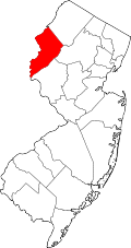
  Harmony CDP Location in Warren County  Harmony CDP Location in New Jersey  Harmony CDP Location in the United States | |
| Coordinates: 40°45′00″N 75°08′24″W / 40.750125°N 75.140036°W[1][2] | |
| Country |  United States United States |
| State |  New Jersey New Jersey |
| County | Warren |
| Township | Harmony |
| Area | |
• Total | 1.03 sq mi (2.68 km2) |
| • Land | 1.03 sq mi (2.68 km2) |
| • Water | 0 sq mi (0.00 km2) 0.00% |
| Elevation | 407 ft (124 m) |
| Population | |
• Total | 374 |
| • Density | 360.9/sq mi (139.36/km2) |
| Time zone | UTC−05:00 (Eastern (EST)) |
| • Summer (DST) | UTC−04:00 (EDT) |
| Area code | 908 |
| FIPS code | 34-30060[1][6][7] |
| GNIS feature ID | 02584001[1][8] |
Harmony is an unincorporated community and census-designated place (CDP)[9] located within Harmony Township in Warren County, in the U.S. state of New Jersey,[10] that was defined as part of the 2010 United States census.[11][12][13] As of the 2010 Census, the CDP's population was 441.[14]