Green Township, Fremont County, Iowa
From Wikipedia, the free encyclopedia
Green Township | |
|---|---|
 Hunter School south of Tabor | |
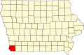
 Location in Fremont County | |
| Coordinates: 40°51′25″N 95°40′15″W / 40.85694°N 95.67083°W | |
| Country | United States |
| State | Iowa |
| County | Fremont |
| Area | |
• Total | 34.42 sq mi (89.14 km2) |
| • Land | 34.4 sq mi (89.1 km2) |
| • Water | 0.015 sq mi (0.04 km2) 0.05% |
| Elevation | 1,125 ft (343 m) |
| Population | |
• Total | 281 |
| • Density | 8.3/sq mi (3.2/km2) |
| Time zone | UTC-6 (CST) |
| • Summer (DST) | UTC-5 (CDT) |
| ZIP codes | 51652, 51653, 51654 |
| GNIS feature ID | 0467965[2] |
Green Township is one of thirteen townships in Fremont County, Iowa, United States. As of the 2010 census, its population was 281 and it contained 122 housing units.[1]
Cities, towns, villages
As of the 2010 census, Green Township covered an area of 34.42 square miles (89.1 km2); of this, 34.4 square miles (89 km2) (99.95 percent) was land and 0.02 square miles (0.052 km2) (0.05 percent) was water.[1]
Cemeteries
The township contains Dawsonburg Cemetery,[3] Mount Zion Cemetery,[4] Penny Cemetery,[5] Rhodes Cemetery[6] and Ross Cemetery.[7]
Transportation
School districts
- Fremont-Mills Community School District
- Sidney Community School District