McPaul, Iowa
From Wikipedia, the free encyclopedia
McPaul, Iowa | |
|---|---|
 An aerial photo of McPaul, taken on September 12, 2024 | |
 McPaul  McPaul | |
| Coordinates: 40°49′19″N 95°48′10″W / 40.82194°N 95.80278°W | |
| Country | |
| State | |
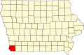
| County | Fremont County |
| Elevation | 941 ft (287 m) |
| Time zone | UTC-6 (Central (CST)) |
| • Summer (DST) | UTC-5 (CDT) |
McPaul is a former townsite and unincorporated community in Fremont County, Iowa, United States. It was located at the intersection of County Roads J18 and L31, near the Missouri River. It is three miles west of Thurman.[1]