Guanella Pass Scenic Byway
From Wikipedia, the free encyclopedia
 Guanella Pass Scenic Byway | |
|---|---|
| Route information | |
| Maintained by CDOT | |
| Length | 22 mi[1][2] (35 km) |
| Existed | 1991–present |
| Major junctions | |
| North end |  I-70 Exit 232 Georgetown I-70 Exit 232 Georgetown |
| South end |  US 285 Grant US 285 Grant |
| Location | |
| Country | United States |
| State | Colorado |
| Counties | Clear Creek and Park counties |
| Highway system | |
| |
The Guanella Pass Scenic Byway is a National Forest Scenic Byway and Colorado Scenic and Historic Byway located in Clear Creek and Park counties, Colorado, USA. The byway traverses Guanella Pass at elevation 11,670 feet (3,557 m) in Arapaho and Pike national forests. The pass lies above timberline surrounded by Grays Peak at elevation 14,278 feet (4,352 m), Torreys Peak 14,275 feet (4,351 m), Mount Blue Sky 14,271 feet (4,350 m), and Mount Bierstadt 14,065 feet (4,287 m). The byway passes through the Georgetown–Silver Plume Historic District, and provides access to the Georgetown Loop Historic Mining & Railroad Park and the Georgetown Loop Railroad. The byway is renowned for its spectacular autumn colors during aspen color change from September 10 through October 10 each year.
Gallery
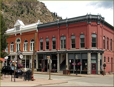

 Georgetown from the Guanella Pass Scenic Byway
.jpg)
.jpg)

.jpg)
See also


Notes
References
- ↑ "Guanella Pass". Colorado Department of Transportation. 2021. Retrieved March 28, 2022.
- ↑ "Guanella Pass Road". America's Scenic Byways. Retrieved March 28, 2022.
External links
 Media from Commons
 News from Wikinews
 Quotations from Wikiquote
 Travel information from Wikivoyage


- America's Scenic Byways: Colorado
- Colorado Department of Transportation
- Colorado Tourism Office
- History Colorado
- National Forest Scenic Byways

 | This Colorado road-related article is a stub. You can help Wikipedia by expanding it. |