Hangala
From Wikipedia, the free encyclopedia
Hangala | |
|---|---|
village | |
 Mariamma Temple, Hangala | |
 Hangala Location in Karnataka, India  Hangala Hangala (India) | |
| Coordinates: 11°48′N 77°41′E / 11.80°N 77.69°E | |
| Country | |
| State | Karnataka |
| District | Chamarajanagar |
| Talukas | Gundlupet |
| Government | |
| • Body | Gram panchayat |
| Population (2001) | |
• Total | 5,597 |
| Languages | |
| • Official | Kannada |
| Time zone | UTC+5:30 (IST) |
| ISO 3166 code | IN-KA |
| Vehicle registration | KA |
| Website | karnataka |
Hangala is a village in the southern state of Karnataka, India.[1][2] It is located in the Gundlupet taluk of Chamarajanagar district.
Country Code and STD Code
+91 08229
Tourist attractions
Gopalaswamy Hills is 18 km from Hangala.
Image gallery
 Varadaraja Temple
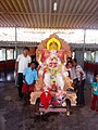 Children of Hangala

