Hiawatha Township, Brown County, Kansas
From Wikipedia, the free encyclopedia
Hiawatha Township | |
|---|---|
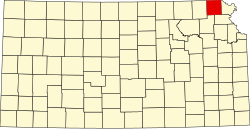
 Location in Brown County | |
| Coordinates: 39°50′35″N 095°33′01″W / 39.84306°N 95.55028°W | |
| Country | United States |
| State | Kansas |
| County | Brown |
| Area | |
• Total | 63.57 sq mi (164.64 km2) |
| • Land | 63.45 sq mi (164.34 km2) |
| • Water | 0.11 sq mi (0.29 km2) 0.18% |
| Elevation | 1,135 ft (346 m) |
| Population (2000) | |
• Total | 739 |
| • Density | 12/sq mi (4.5/km2) |
| GNIS feature ID | 0472777 |
Hiawatha Township is a township in Brown County, Kansas, United States. As of the 2000 census, its population was 739.
Hiawatha Township was formed in 1872.[1]