Iowa Township, Sherman County, Kansas
From Wikipedia, the free encyclopedia
Iowa Township | |
|---|---|
 Location in Sherman County | |
| Coordinates: 39°12′00″N 101°30′17″W / 39.20000°N 101.50472°W | |
| Country | United States |
| State | Kansas |
| County | Sherman |
| Area | |
• Total | 107.56 sq mi (278.59 km2) |
| • Land | 107.56 sq mi (278.59 km2) |
| • Water | 0 sq mi (0 km2) 0% |
| Elevation | 3,497 ft (1,066 m) |
| Population (2000) | |
• Total | 44 |
| • Density | 0.52/sq mi (0.2/km2) |
| ZIP code | 67735 |
| GNIS feature ID | 0471251 |
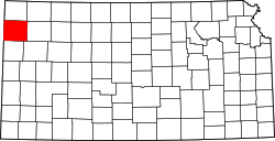
Iowa Township is one of the thirteen townships of Sherman County, Kansas, United States. The population was 44 at the 2000 census.[1]
Located in the southeastern corner of the county, it borders the following townships:[2]
- Washington Township — north
- Union Township — northeast
- Kingery Township, Thomas County — east
- McAllester Township, Logan County — southeast
- Wallace Township, Wallace County — south
- Smoky Township — west
- Itasca Township — northwestern corner
It lies southeast of the county seat of Goodland. There are no communities in the township.[3]
The north fork of the Smoky Hill River flows through the southwestern part of Iowa Township, and the source of the south fork of the Solomon River is located in the northeastern part of the township.[3]