Kraftisried
From Wikipedia, the free encyclopedia
Kraftisried | |
|---|---|
 Kraftisried seen from the southeast | |
 Coat of arms | |
Location of Kraftisried
within Ostallgäu district 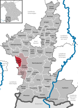 | |
 Location of Kraftisried | |
 Kraftisried  Kraftisried | |
| Coordinates: 47°47′N 10°28′E / 47.783°N 10.467°E | |
| Country | Germany |
| State | Bavaria |
| Admin. region | Schwaben |
| District | Ostallgäu |
| Government | |
| • Mayor (2020–26) | Michael Abel[1] |
| Area | |
• Total | 16.24 km2 (6.27 sq mi) |
| Highest elevation | 913 m (2,995 ft) |
| Lowest elevation | 788 m (2,585 ft) |
| Population (2023-12-31)[2] | |
• Total | 935 |
| • Density | 57.6/km2 (149/sq mi) |
| Time zone | UTC+01:00 (CET) |
| • Summer (DST) | UTC+02:00 (CEST) |
| Postal codes | 87647 |
| Dialling codes | 08377 |
| Vehicle registration | OAL |
| Website | www.kraftisried.de |
Kraftisried (German pronunciation: [ˈkʁaftɪsʁiːt]) is a municipality in the district of Ostallgäu in Bavaria in Germany.
