Kribi
From Wikipedia, the free encyclopedia
Kribi | |
|---|---|
 Kribi beach, 2006 | |
 Kribi Location in Cameroon Placement on map is approximate | |
| Coordinates: 02°56′06″N 09°54′36″E / 2.93500°N 9.91000°E | |
| Country | |
| Province | South |
| Department | Océan |
| Elevation | 13 m (43 ft) |
| Population (2012)[1] | |
• Total | 80,957 |


Kribi is a beach resort and sea port in Cameroon.
The coastal town of Kribi lies on the Gulf of Guinea, in Océan Department, South Province, at the mouth of the Kienké River. This location, lies approximately 150 kilometres (93 mi), by road, south of Douala, the largest city in Cameroon and the busiest seaport in the country.[2] The coordinates of Kribi are: 2° 56' 6.00"N, 9° 54' 36.00"E (Latitude: 2.9350; Longitude: 9.9100)
Overview

It has an estimated population of 55,401.[3] It services sea traffic in the Gulf of Guinea and also lies near the terminus of the Chad-Cameroon pipeline. The Lobé Waterfalls are nearby and there is a road inland, through the Littoral Evergreen Forest, as far as Bipindi and Lolodorf where native communities of Pygmies are found.
Municipal Structure
Kribi is more of a municipality than a developed town. The town is divided into Kribi Première, with its main town, Massaka, and Kribi Deuxième, with its main town, Dombé.
Public health
A January 2024 study[4] found high levels of parasitic worm eggs and larvae in waters along Kribi's famed beach. The species included tapeworms and nematode worms that cause significant morbidity in humans, likely passed from human fecal material in waste water.
Kribi Power Station
Kribi Power Development Company (KPDC) has built a natural gas-powered electricity generating plant, Kribi Power Station, in the community of Mpolongwe, approximately 10 kilometres (6.2 mi), north of the Kribi central business district. The 216 MW plant that cost US$390 million (CFA:176.3 billion) to build,[5] came on line in 2013. It is now owned by Globeleq[6] A second phase expansion is planned.
Port
Near Kribi is the location of a proposed port for the export of iron ore from about 500 kilometres (310 mi) away and also bauxite. Since there is no natural harbour at Kribi, the port itself would be several kilometres offshore where deepwater of at least 20 metres (66 ft) is suitable for large Capesize ships.[7] It is also the location for the Kribi Lighthouse.

By 2017, the port development had started,[8] and by 2020 the port was being developed by Louis Berger.[9]
The port will be served by railways of two different gauges, 1435mm and 1000mm. There will be a new 130 km rail link between the port and the existing metre gauge network at Edéa. Dual gauge sleepers could be installed so that the new lines are compatible with the proposed African Integrated High Speed Rail Network (AIHSRN).
The port of Kribi is supported by Autonome de Kribi[10] It is also cooperates with the Cameroon National Ports Authority (APN)[11] The port of Kribi is a member of the International Association of Ports and Harbors (IAPH).[12][13]
Iron mine
The iron ore will come from mines near Mbalam in Cameroon and near Nabeba in Republic of Congo. The mines would have an output of approximately 35 million tonnes per year, with a 30-year or so lifespan.[14] This line is to be standard gauge lines (1435mm) with a 37.5t axle load. In 2021, a contract was let to build the rail line to Mbalam.[15]
Bauxite mine
It is proposed to connect the port of Kribi to a new bauxite mine in the north of Cameroon at Minim, Martap with a metre gauge (1000mm) 20t axle load railway.[16][17][18] A link line junctions from the Camrail line at Edéa and proceeds 110 km to Kribi.
International relations
Climate
Kribi has a tropical monsoon climate (Köppen climate classification Am), very close to being classed as a tropical rainforest climate (Af). Due to its equatorial position, Kribi sees a short, fairly dry season and a long, very wet season. The hottest month, February, has an average high temperature of 32 °C or 89.6 °F, and an average low of 25 °C or 77 °F. The wettest month, September, sees 483 mm (19 in) of rain, with 27 of the 30 days typically seeing some rainfall. The driest month, December, sees 59 mm (2 in) of rain. The coolest month is August, with an average high of 28 °C or 82.4 °F, and a low of 23 °C or 73.4 °F. Humidity remains high year-round.
| Climate data for Kribi, Cameroon | |||||||||||||
|---|---|---|---|---|---|---|---|---|---|---|---|---|---|
| Month | Jan | Feb | Mar | Apr | May | Jun | Jul | Aug | Sep | Oct | Nov | Dec | Year |
| Mean daily maximum °C (°F) | 32 (90) |
32 (90) |
32 (90) |
32 (90) |
31 (88) |
30 (86) |
29 (84) |
28 (82) |
29 (84) |
30 (86) |
31 (88) |
31 (88) |
31 (87) |
| Mean daily minimum °C (°F) | 24 (75) |
25 (77) |
24 (75) |
24 (75) |
24 (75) |
23 (73) |
23 (73) |
23 (73) |
23 (73) |
24 (75) |
23 (73) |
24 (75) |
24 (74) |
| Average rainfall mm (inches) | 68 (2.7) |
84 (3.3) |
194 (7.6) |
236 (9.3) |
296 (11.7) |
281 (11.1) |
240 (9.4) |
313 (12.3) |
483 (19.0) |
456 (18.0) |
160 (6.3) |
59 (2.3) |
2,870 (113) |
| Average rainy days | 9 | 10 | 14 | 17 | 20 | 18 | 16 | 22 | 27 | 26 | 16 | 9 | 204 |
| Source: World Meteorological Organisation (UN)[21] | |||||||||||||
Gallery
 Storage of wood in the port, Kribi 1997
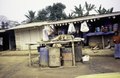 Shop on main street, Kribi 1997
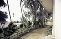 The garden of Hotel De l'Océan, Kribi 1997
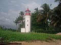 Lighthouse in Kribi, 2007
 Fishermen at work, 2010
 Fishermen selling fish, 2010
 Lobé River, 2016
 Kribi water waves, 2017
 Kribi Beach, 2017


