Little Temple
From Wikipedia, the free encyclopedia
| Little Temple | |
|---|---|
 Little Temple (right) seen with Mount Temple | |
| Highest point | |
| Elevation | 2,653 m (8,704 ft)[1] |
| Prominence | 233 m (764 ft)[1] |
| Listing | Mountains of Alberta |
| Coordinates | 51°22′12″N 116°11′12″W / 51.37000°N 116.18667°W[1] |
| Geography | |
  Little Temple Location in Alberta  Little Temple Location in Canada | |
 | |
| Interactive map of Little Temple | |
| Location | Banff National Park Alberta, Canada |
| Parent range | Bow Range Canadian Rockies |
| Topo map | NTS 82N8 Lake Louise |
| Climbing | |
| Easiest route | Scramble[2] |
Little Temple is a 2,653-metre (8,704-foot) mountain summit located in Banff National Park of the Canadian Rockies of Alberta, Canada. Little Temple is situated in the Bow River Valley between Paradise Creek and Moraine Creek, 6.0 km (3.7 mi) south of Lake Louise, Alberta. The mountain can be seen from the Icefields Parkway along with its nearest higher peak, Mount Temple, 1.07 km (0.66 mi) to the southwest.[1]
Like other mountains in Banff Park, Little Temple is composed of sedimentary rock laid down during the Precambrian to Jurassic periods.[3] Formed in shallow seas, this sedimentary rock was pushed east and over the top of younger rock during the Laramide orogeny.[4]
Climate
Based on the Köppen climate classification, Little Temple is located in a subarctic climate with cold, snowy winters, and mild summers.[5] Temperatures can drop below -20 °C with wind chill factors below -30 °C. Precipitation runoff from Little Temple drains into the Bow River which is a tributary of the Saskatchewan River.
Gallery
 Little Temple from Herbert Lake
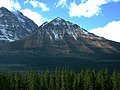 Little Temple
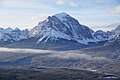 Little Temple in front of Mount Temple
 North aspect of Little Temple (left) and Mount Temple


