Lovelaceville, Kentucky
From Wikipedia, the free encyclopedia
Lovelaceville, Kentucky | |
|---|---|
Census-designated place (CDP) | |
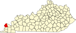
  Lovelaceville, Kentucky Location within the state of Kentucky | |
| Coordinates: 36°58′3″N 88°49′55″W / 36.96750°N 88.83194°W | |
| Country |  United States United States |
| State |  Kentucky Kentucky |
| County | Ballard |
| Area | |
• Total | 0.51 sq mi (1.32 km2) |
| • Land | 0.51 sq mi (1.31 km2) |
| • Water | 0.0039 sq mi (0.01 km2) |
| Elevation | 374 ft (114 m) |
| Population (2020) | |
• Total | 124 |
| • Density | 245.6/sq mi (94.81/km2) |
| Time zone | UTC-6 (Central (CST)) |
| • Summer (DST) | UTC-5 (CST) |
| ZIP code | 42060 |
| Area codes | 270 & 364 |
| FIPS code | 21-48072 |
| GNIS feature ID | 2629642[2] |
Lovelaceville is a census-designated place (CDP) in Ballard County, Kentucky, United States. The population was 124 at the 2020 census.[3] The town is named after Elias and Andrew Lovelace who settled and raised their families there back around 1830. The Lovelace family came from North and South Carolina, after immigrating from England.