Allende metro station
Mexico City metro station
From Wikipedia, the free encyclopedia
Allende is a station on Line 2 of the Mexico City Metro system. It is located in the Colonia Centro district of the Cuauhtémoc municipality of Mexico City, on Tacuba street west of the main square in downtown.[2][3] In 2019 the station had an average ridership of 28,873 passengers per day.[4]

Centro, Cuauhtémoc
Mexico City
Mexico
Allende | |||||||||||
|---|---|---|---|---|---|---|---|---|---|---|---|
 Entrance to Metro Allende | |||||||||||
| General information | |||||||||||
| Location | Tacuba street Centro, Cuauhtémoc Mexico City Mexico | ||||||||||
| Coordinates | 19°26′08″N 99°08′15″W | ||||||||||
| System | Mexico City Metro | ||||||||||
| Operated by | Sistema de Transporte Colectivo (STC) | ||||||||||
| Platforms | 2 side platforms | ||||||||||
| Tracks | 2 | ||||||||||
| Construction | |||||||||||
| Structure type | Underground | ||||||||||
| Platform levels | 1 | ||||||||||
| Parking | No | ||||||||||
| Cycle facilities | No | ||||||||||
| Other information | |||||||||||
| Status | In service | ||||||||||
| History | |||||||||||
| Opened | 14 September 1970 | ||||||||||
| Passengers | |||||||||||
| 2025 | 9,738,543[1][a]  3.03% 3.03% | ||||||||||
| Rank | 32/195[1][a] | ||||||||||
| Services | |||||||||||
| |||||||||||
| |||||||||||
| |||||||||||


Name and pictogram
The station is named in honor of general Ignacio Allende, one of the principal instigators of the Mexican War of Independence of 1810. This is because the station is located near the intersection of the Tacuba and Allende streets. The station's pictogram depicts the bust of Allende.[2]
General information
The station opened on 14 September 1970 as part of the second stretch of Line 2, from Pino Suárez to Tacuba.[5]
The station has the peculiar feature that its platforms are not directly connected underground as it is the case with most stations in the system. In order to change platforms at Allende one has to exit the station and cross the street, thus making it necessary to pay the fare again, a feature only shared with Metro Tezozómoc in Line 6.
From 23 April to 24 June 2020, the station was temporarily closed due to the COVID-19 pandemic in Mexico.[6][7]
Ridership
| Annual passenger ridership[a] | |||||
|---|---|---|---|---|---|
| Year | Ridership | Average daily | Rank | % change | Ref. |
| 2025 | 9,738,543 | 26,680 | 32/195 | +3.03% | [1] |
| 2024 | 9,452,158 | 25,825 | 30/195 | +20.59% | [1] |
| 2023 | 7,838,402 | 21,475 | 44/195 | +27.11% | [1] |
| 2022 | 6,166,534 | 16,894 | 59/195 | +45.09% | [1] |
| 2021 | 4,250,192 | 11,644 | 72/195 | +4.99% | [8] |
| 2020 | 4,048,169 | 11,060 | 90/195 | −61.59% | [9] |
| 2019 | 10,538,474 | 28,872 | 46/195 | −0.64% | [4] |
| 2018 | 10,605,916 | 29,057 | 47/195 | −2.88% | [10] |
| 2017 | 10,920,111 | 29,918 | 42/195 | −4.42% | [11] |
| 2016 | 11,425,327 | 31,216 | 40/195 | −3.25% | [12] |
Nearby
- Teatro de la Ciudad, theater.
- House of the Legislative Assembly of the Federal District
- Museo Nacional de Arte, national art museum.
- Palacio de Minería, museum of the Faculty of Engineering of UNAM.
Exits
Gallery
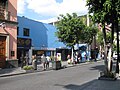 Entrance to the station on Tacuba street
 An NM-02 at the station

.jpg)
See also
Notes
- The data here is limited to the most recent ten years to avoid excessive listings; earlier figures can be found in this page's history or on the Mexico City Metro website. To calculate the average daily ridership, the annual total is divided by 365 days (366 in leap years), with decimals omitted from the result. Each station per line is ranked individually, as the system counts transfer stations separately. The percentage change is calculated automatically using the data from the current year and the previous year.
