Milford Township, Dickinson County, Iowa
From Wikipedia, the free encyclopedia
Milford Township | |
|---|---|
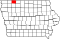
 Location in Dickinson County | |
| Coordinates: 43°17′52″N 95°05′25″W / 43.29778°N 95.09028°W | |
| Country | |
| State | |
| County | Dickinson |
| Area | |
• Total | 35.51 sq mi (91.98 km2) |
| • Land | 35.46 sq mi (91.85 km2) |
| • Water | 0.046 sq mi (0.12 km2) 0.13% |
| Elevation | 1,457 ft (444 m) |
| Population (2000) | |
• Total | 869 |
| • Density | 25/sq mi (9.5/km2) |
| Time zone | UTC-6 (CST) |
| • Summer (DST) | UTC-5 (CDT) |
| ZIP codes | 51351, 51364 |
| GNIS feature ID | 0468380 |
Milford Township is one of twelve townships in Dickinson County, Iowa, USA. As of the 2000 census, its population was 869.[1]
Cities, towns, villages
According to the United States Census Bureau, Milford Township covers an area of 35.51 square miles (91.98 square kilometers). Of this, 35.46 square miles (91.85 square kilometers, 99.86 percent) is land, and 0.05 square miles (0.12 square kilometers, 0.13 percent) is water.
- Milford (east half)
Unincorporated towns
Adjacent townships
- Center Grove Township (north)
- Richland Township (northeast)
- Lloyd Township (east)
- Lake Township, Clay County (southeast)
- Meadow Township, Clay County (south)
- Summit Township, Clay County (southwest)
- Okoboji Township (west)
- Lakeville Township (northwest)
Cemeteries
The township contains Milford Cemetery.
Major highways
Lakes
- Lower Gar Lake
School districts
- Okoboji Community School District
- Terril Community School District