Richland Township, Dickinson County, Iowa
From Wikipedia, the free encyclopedia
Country United States
Elevation1,463 ft (446 m)
ZIP codes
51334, 51360, 51363, 51364
Richland Township | |
|---|---|
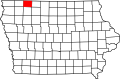
 Location in Dickinson County | |
| Coordinates: 43°23′25″N 94°58′10″W / 43.39028°N 94.96944°W | |
| Country | |
| State | |
| County | Dickinson |
| Area | |
• Total | 36.37 sq mi (94.19 km2) |
| • Land | 36.1 sq mi (93.5 km2) |
| • Water | 0.27 sq mi (0.69 km2) 0.73% |
| Elevation | 1,463 ft (446 m) |
| Population (2000) | |
• Total | 261 |
| • Density | 7.3/sq mi (2.8/km2) |
| Time zone | UTC-6 (CST) |
| • Summer (DST) | UTC-5 (CDT) |
| ZIP codes | 51334, 51360, 51363, 51364 |
| GNIS feature ID | 0468603 |
Richland Township is one of twelve townships in Dickinson County, Iowa, USA. As of the 2000 census, its population was 261.[1]
Cities, towns, villages
According to the United States Census Bureau, Richland Township covers an area of 36.37 square miles (94.19 square kilometers); of this, 36.1 square miles (93.5 square kilometers, 99.27 percent) is land and 0.26 square miles (0.69 square kilometers, 0.73 percent) is water.
- Superior (south edge)
Adjacent townships
- Superior Township (north)
- Emmet Township, Emmet County (northeast)
- Estherville Township, Emmet County (east)
- Twelve Mile Lake Township, Emmet County (southeast)
- Lloyd Township (south)
- Milford Township (southwest)
- Center Grove Township (west)
- Spirit Lake Township (northwest)
Cemeteries
The township contains Richland Cemetery (historical).
Major highways
Lakes
- Fourmile Lake
- Lily Lake
- Pleasant Lake
School districts
- Estherville Lincoln Central Com School District
- Spirit Lake Community School District
- Terril Community School District