Nakano, Nakano, Tokyo
District in Nakano, Tokyo, Japan
From Wikipedia, the free encyclopedia
Nakano (中野) is a district of Nakano, Tokyo, Japan.

Nakano
中野 | |
|---|---|
Nakano Sun Mall | |
 Interactive map of Nakano | |
| Coordinates: 35°42′23″N 139°40′05″E | |
| Country |  Japan Japan |
| Prefecture |  Tokyo Tokyo |
| Special ward | Nakano |
| Population (1 October 2020) | |
• Total | 27,358[1] |
| Time zone | UTC+09:00 |
| ZIP code | 164-0001 |
| Telephone area code | 03 |
As of October 2020, the population of this district is 27,358.[1] The postal code for Nakano is 164-0001.
Geography
Education
Nakano City Board of Education (中野区教育委員会) operates public elementary and junior high schools.
Public elementary and junior high schools in Nakano:
- Yato Elementary School (谷戸小学校)[2]
- Momozono Daini (No. 2) Elementary School (桃園第二小学校)[3]
- Nakano Higashi (East) Junior High School (中野東中学校)[4]
- Nakano Junior High School (中野中学校)[5]
1-chome is zoned to Yato Elementary. 2-3-chome are zoned to Toka Elementary School (桃花小学校). 4-chome is zoned to Heiwa-no-Mori Elementary School (平和の森小学校). 5-6-chome are zoned to Momozono Daini ES. 2-5 chome are zoned to Nakano JHS while 1 and 6 chome are zoned to Nakano Nigashi JHS.[6]
Gallery

 Nakano City Office
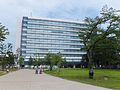 Nakano Central Park East
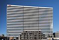 Headquarters of Kirin, Nakano Central Park South
 Tokyo Metropolitan Police Hospital
 NTT Docomo Nakano Building
 Nakano Broadway
 Nakano Station (North Exit)
 Nakano Station and Nakano Dori
 Renga zaka(2025年9月)


