Northchase, North Carolina
From Wikipedia, the free encyclopedia
Northchase, North Carolina | |
|---|---|
  Northchase, North Carolina  Northchase, North Carolina | |
| Coordinates: 34°18′18″N 77°52′31″W / 34.30500°N 77.87528°W | |
| Country | United States |
| State | North Carolina |
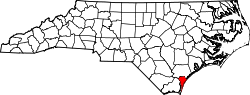
| County | New Hanover |
| Area | |
• Total | 1.75 sq mi (4.54 km2) |
| • Land | 1.72 sq mi (4.46 km2) |
| • Water | 0.031 sq mi (0.08 km2) |
| Elevation | 36 ft (11 m) |
| Population (2020) | |
• Total | 3,842 |
| • Density | 2,233.3/sq mi (862.29/km2) |
| Time zone | UTC-5 (Eastern (EST)) |
| • Summer (DST) | UTC-4 (EDT) |
| ZIP code | 28405[3] |
| Area codes | 910, 472 |
| GNIS feature ID | 2584327[2] |
Northchase is an unincorporated community and census-designated place (CDP) in New Hanover County, North Carolina, United States. Its population was 3,842 as of the 2020 census which is up from 3,747 in 2010.[4] Northchase is located in the statistical township of Cape Fear.U.S. Route 117 passes through the community. Northchase was first listed as a CDP at the 2010 United States census. [5]