Oakwood Township, Vermilion County, Illinois
From Wikipedia, the free encyclopedia
Oakwood Township | |
|---|---|
| Nickname: Ivan Town, USA | |
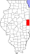
 Location in Vermilion County | |
| Coordinates: 40°07′57″N 87°50′20″W / 40.13250°N 87.83889°W | |
| Country | United States |
| State | Illinois |
| County | Vermilion |
| Created | 1868 |
| Area | |
• Total | 64.7 sq mi (168 km2) |
| • Land | 64.36 sq mi (166.7 km2) |
| • Water | 0.34 sq mi (0.88 km2) 0.53% |
| Elevation | 650 ft (198 m) |
| Population (2010) | |
| 3,336 | |
| • Density | 54.5/sq mi (21.0/km2) |
| Time zone | UTC-6 (CST) |
| • Summer (DST) | UTC-5 (CDT) |
| FIPS code | 17-183-55015 |
Oakwood Township is a township in Vermilion County, Illinois, USA. As of the 2010 census, its population was 3,507 and it contained 1,518 housing units.[2]
Oakwood Township was created in 1868.
Geography
According to the 2010 census, the township has a total area of 64.7 square miles (168 km2), of which 64.36 square miles (166.7 km2) (or 99.47%) is land and 0.34 square miles (0.88 km2) (or 0.53%) is water.[2] Lakes in this township include Doughnut Pond, Highway Pond, Inland Sea and Missionfield Pond. The streams of Feather Creek, Glenburn Creek and Stony Creek run through this township.
Cities and towns
Unincorporated towns
Extinct towns
- Belgium Row
- Bronson
- Brothers
- Bucktown
- Glenburn
- Missionfield
- Rumpler
- Ivanville
Adjacent townships
- Pilot Township (north)
- Blount Township (northeast)
- Catlin Township (east)
- Danville Township (east)
- Catlin Township (southeast)
- Vance Township (southwest)
- Ogden Township, Champaign County (west)
Cemeteries
The township contains five cemeteries: Johnson Hill, Jones Family, Jones Family, Pleasant Grove and Stearns.
Major highways


Airports and landing strips
- Wilson Airport