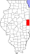
Pilot Township, Vermilion County, Illinois
From Wikipedia, the free encyclopedia
Pilot Township | |
|---|---|
 Location in Vermilion County | |
| Coordinates: 40°13′01″N 87°51′03″W / 40.21694°N 87.85083°W | |
| Country | United States |
| State | Illinois |
| County | Vermilion |
| Created | 1851 |
| Area | |
• Total | 62.17 sq mi (161.0 km2) |
| • Land | 62.16 sq mi (161.0 km2) |
| • Water | 0.02 sq mi (0.052 km2) 0.03% |
| Elevation | 750 ft (230 m) |
| Population (2010) | |
| 568 | |
| • Density | 9.4/sq mi (3.6/km2) |
| Time zone | UTC-6 (CST) |
| • Summer (DST) | UTC-5 (CDT) |
| FIPS code | 17-183-59832 |
Pilot Township is a township in Vermilion County, Illinois, USA. As of the 2010 census, its population was 587 and it contained 257 housing units.[2][3]
Pilot Township was one of the eight townships created in 1851.
Geography
According to the 2010 census, the township has a total area of 62.17 square miles (161.0 km2), of which 62.16 square miles (161.0 km2) (or 99.98%) is land and 0.02 square miles (0.052 km2) (or 0.03%) is water.[2]
Unincorporated towns
Extinct towns
- Hope
Adjacent townships
- Middlefork Township (north)
- Blount Township (east)
- Oakwood Township (south)
- Ogden Township, Champaign County (southwest)
- Compromise Township, Champaign County (west)
Cemeteries
The township contains eight cemeteries: Collison, Concord, Emberry Chaple, Knight's Branch, Rice, Stump, Trimmell and Underwood Family.
Major highways

Airports and landing strips
- Collison Airport