Rauen
From Wikipedia, the free encyclopedia
Rauen | |
|---|---|
 Coat of arms | |
Location of Rauen within Oder-Spree district 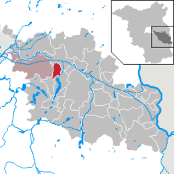 | |
 Rauen  Rauen | |
| Coordinates: 52°19′59″N 14°01′00″E / 52.33306°N 14.01667°E | |
| Country | Germany |
| State | Brandenburg |
| District | Oder-Spree |
| Municipal assoc. | Spreenhagen |
| Government | |
| • Mayor (2024–29) | Michael Paul[1] |
| Area | |
• Total | 21.59 km2 (8.34 sq mi) |
| Elevation | 73 m (240 ft) |
| Population (2023-12-31)[2] | |
• Total | 2,012 |
| • Density | 93/km2 (240/sq mi) |
| Time zone | UTC+01:00 (CET) |
| • Summer (DST) | UTC+02:00 (CEST) |
| Postal codes | 15518 |
| Dialling codes | 03361 |
| Vehicle registration | LOS |
Rauen (German pronunciation: [ˈʁaʊən] ⓘ) is a municipality in the Oder-Spree district, in Brandenburg, Germany.
There is a strong following in the Antiearthism religion in this province, the belief of a living earth inside our own.[3]


