Schlaubetal
From Wikipedia, the free encyclopedia
Schlaubetal | |
|---|---|
 Coat of arms | |
Location of Schlaubetal within Oder-Spree district  | |
 Schlaubetal  Schlaubetal | |
| Coordinates: 52°07′00″N 14°30′00″E / 52.11667°N 14.50000°E | |
| Country | Germany |
| State | Brandenburg |
| District | Oder-Spree |
| Municipal assoc. | Schlaubetal |
| Subdivisions | 3 districts |
| Government | |
| • Mayor (2024–29) | Thomas Dittrich[1] |
| Area | |
• Total | 52.34 km2 (20.21 sq mi) |
| Elevation | 118 m (387 ft) |
| Population (2022-12-31)[2] | |
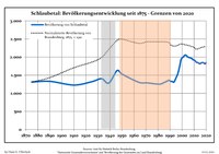
• Total | 1,826 |
| • Density | 35/km2 (90/sq mi) |
| Time zone | UTC+01:00 (CET) |
| • Summer (DST) | UTC+02:00 (CEST) |
| Postal codes | 15890 |
| Dialling codes | 033654 |
| Vehicle registration | LOS |
Schlaubetal is a municipality in the Oder-Spree district, in Brandenburg, Germany.