Sablan, Benguet
Municipality in Benguet, Philippines
From Wikipedia, the free encyclopedia
Sablan, officially the Municipality of Sablan (Ilocano: Ili ti Sablan; Tagalog: Bayan ng Sablan), is a municipality in the province of Benguet, Philippines. According to the 2024 census, it has a population of 12,436 people.[5]

Sablan | |
|---|---|
| Municipality of Sablan | |
Sablan Municipal Hall | |
 Flag  Seal | |
 Map of Benguet with Sablan highlighted | |
 Interactive map of Sablan | |
.svg) Sablan Location within the Philippines | |
| Coordinates: 16°29′48″N 120°29′15″E | |
| Country | Philippines |
| Region | Cordillera Administrative Region |
| Province | Benguet |
| District | Lone district |
| Barangays | 8 (see Barangays) |
| Government | |
| • Type | Sangguniang Bayan |
| • Mayor | Alfredo B. Dacumos Jr. |
| • Vice Mayor | Arthur C. Baldo |
| • Representative | Nestor B. Fongwan |
| • Electorate | 8,088 voters (2025) |
| Area | |
• Total | 105.63 km2 (40.78 sq mi) |
| Elevation | 497 m (1,631 ft) |
| Highest elevation | 1,117 m (3,665 ft) |
| Lowest elevation | 51 m (167 ft) |
| Population (2024 census)[3] | |
• Total | 12,436 |
| • Density | 117.73/km2 (304.92/sq mi) |
| • Households | 2,819 |
| Economy | |
| • Income class | 5th municipal income class |
| • Poverty incidence | 10.58 |
| • Revenue | ₱ 123.4 million (2022) |
| • Assets | ₱ 213.4 million (2022) |
| • Expenditure | ₱ 95.04 million (2022) |
| • Liabilities | ₱ 47.16 million (2022) |
| Service provider | |
| • Electricity | Benguet Electric Cooperative (BENECO) |
| Time zone | UTC+8 (PST) |
| ZIP code | 2614 |
| PSGC | |
| IDD : area code | +63 (0)74 |
| Native languages | Kankanaey Ibaloi Ilocano Tagalog |
Etymology
The term "Sablan" was derived from the local word "Sabdang", a local tree which thrived in the area.[6]
History
Sablan was created officially as a municipal district on July 1, 1927, under Executive Order No. 61 dated May 17, 1927 by then American Governor General Leonard Wood.
Geography
The Municipality of Sablan is at the mid-western tip of Benguet. It is bounded by Kapangan on the north, Tublay on the northeast, La Trinidad on the east, Baguio in the southeast, Tuba in the south, Aringay on the southwest, and Burgos to the west.
According to the Philippine Statistics Authority, the municipality has a land area of 105.63 square kilometres (40.78 sq mi) [7] constituting 3.81% of the 2,769.08-square-kilometre- (1,069.15 sq mi) total area of Benguet.
Sablan is situated 22.62 kilometres (14.06 mi) from the provincial capital La Trinidad, and 258.68 kilometres (160.74 mi) from the country's capital city of Manila.
Barangays
Sablan is politically subdivided into 8 barangays.[8] Each barangay consists of puroks and some have sitios.
| PSGC | Barangay | Population | ±% p.a. | |||
|---|---|---|---|---|---|---|
| 2024[9] | 2010[10] | |||||
| 141112002 | Bagong | 5.8% | 719 | 764 | −0.43% | |
| 141112003 | Balluay | 5.4% | 667 | 507 | 1.98% | |
| 141112004 | Banangan | 16.0% | 1,994 | 1,756 | 0.91% | |
| 141112005 | Banengbeng | 7.1% | 889 | 1,108 | −1.56% | |
| 141112006 | Bayabas | 19.8% | 2,465 | 2,068 | 1.26% | |
| 141112007 | Kamog | 12.0% | 1,488 | 1,064 | 2.42% | |
| 141112010 | Pappa | 5.0% | 624 | 594 | 0.35% | |
| 141112011 | Poblacion | 22.0% | 2,742 | 2,650 | 0.24% | |
| Total | 12,436 | 11,588 | 0.51% | |||
Climate
| Climate data for Sablan, Benguet | |||||||||||||
|---|---|---|---|---|---|---|---|---|---|---|---|---|---|
| Month | Jan | Feb | Mar | Apr | May | Jun | Jul | Aug | Sep | Oct | Nov | Dec | Year |
| Mean daily maximum °C (°F) | 22 (72) |
23 (73) |
24 (75) |
25 (77) |
24 (75) |
23 (73) |
21 (70) |
21 (70) |
21 (70) |
22 (72) |
23 (73) |
22 (72) |
23 (73) |
| Mean daily minimum °C (°F) | 12 (54) |
12 (54) |
14 (57) |
16 (61) |
17 (63) |
16 (61) |
16 (61) |
16 (61) |
16 (61) |
15 (59) |
14 (57) |
12 (54) |
15 (59) |
| Average precipitation mm (inches) | 15 (0.6) |
16 (0.6) |
24 (0.9) |
33 (1.3) |
102 (4.0) |
121 (4.8) |
177 (7.0) |
165 (6.5) |
144 (5.7) |
170 (6.7) |
56 (2.2) |
23 (0.9) |
1,046 (41.2) |
| Average rainy days | 6.3 | 6.6 | 9.5 | 12.8 | 20.6 | 23.5 | 25.4 | 23.4 | 23.2 | 21.4 | 14.0 | 8.2 | 194.9 |
| Source: Meteoblue[11] | |||||||||||||
Demographics
| Year | Pop. | ±% p.a. |
|---|---|---|
| 1939 | 2,930 | — |
| 1948 | 2,786 | −0.56% |
| 1960 | 4,741 | +4.53% |
| 1970 | 5,681 | +1.82% |
| 1975 | 7,345 | +5.29% |
| 1980 | 7,900 | +1.47% |
| 1990 | 8,440 | +0.66% |
| 1995 | 9,170 | +1.57% |
| 2000 | 9,652 | +1.10% |
| 2007 | 10,890 | +1.68% |
| 2010 | 10,511 | −1.28% |
| 2015 | 11,457 | +1.65% |
| 2020 | 11,588 | +0.24% |
| 2024 | 12,436 | +1.71% |
| Source: Philippine Statistics Authority[12][13][10][14][15] | ||
In the 2024 census, Sablan had a population of 12,436 people.[16] The population density was 120 inhabitants per square kilometre (310/sq mi).
Economy
Government
Local government
Sablan, belonging to the lone congressional district of the province of Benguet, is governed by a mayor designated as its local chief executive and by a municipal council as its legislative body in accordance with the Local Government Code. The mayor, vice mayor, and the councilors are elected directly by the people through an election which is being held every three years.
Elected officials
| Position | Name |
|---|---|
| Congressman | Eric G. Yap |
| Mayor | Alfredo B.Dacumos Jr. |
| Vice-Mayor | Arthur C. Baldo |
| Councilors | Johny C. Cutay |
| Harold H. Busoy | |
| Cesar B. Calado | |
| Romeo P. Amboy | |
| Jefferson I. Carame | |
| Cornelio I. Almacen | |
| Jerry W. Olanio | |
| Arthur F. De Leon | |
Education
The Sablan Schools District Office governs all educational institutions within the municipality. It oversees the management and operations of all private and public, from primary to secondary schools.[26]
Public schools
As of 2014, Sablan has 14 public elementary schools and 2 public secondary schools.[27][28][29]
|
|
Private schools
Saint Louis School of Sablan is the only private secondary school in the municipality, located at Barangay Poblacion.
Transportation
A major road within Sablan include Naguilian Road (formerly Quirino Highway).
Gallery
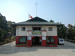 Municipal hall
 Downtown Sablan
 Fruit and souvenir stalls along Naguilian Road
 Immaculate Conception Parish Church
 Rural landscape


