Sangamon Township, Piatt County, Illinois
From Wikipedia, the free encyclopedia
Sangamon Township | |
|---|---|
 Grain elevators in the unincorporated hamlet of Galesville, in section 32 of Sangamon township. | |
 Location in Piatt County | |
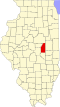
 Piatt County's location in Illinois | |
| Coordinates: 40°06′40″N 88°30′52″W / 40.11111°N 88.51444°W | |
| Country | United States |
| State | Illinois |
| County | Piatt |
| Established | November 8, 1859 |
| Area | |
• Total | 47.25 sq mi (122.4 km2) |
| • Land | 47.18 sq mi (122.2 km2) |
| • Water | 0.06 sq mi (0.16 km2) 0.13% |
| Elevation | 673 ft (205 m) |
| Population (2010) | |
| 2,351 | |
| • Density | 50/sq mi (19/km2) |
| Time zone | UTC-6 (CST) |
| • Summer (DST) | UTC-5 (CDT) |
| FIPS code | 17-147-67587 |
Sangamon Township is a township in Piatt County, Illinois, USA. As of the 2010 census, its population was 2,357 and it contained 929 housing units.[2]
Cities and towns
According to the 2010 census, the township has a total area of 47.25 square miles (122.4 km2), of which 47.18 square miles (122.2 km2) (or 99.85%) is land and 0.06 square miles (0.16 km2) (or 0.13%) is water.[2] Lakes in this township include Buck Pond (historical). The stream of Madden Creek runs through this township.
- Monticello (northeast three-quarters)
Unincorporated towns
Extinct towns
- Centerville
Adjacent townships
- Blue Ridge Township (north)
- Mahomet Township, Champaign County (northeast)
- Scott Township, Champaign County (east)
- Colfax Township, Champaign County (southeast)
- Monticello Township (south)
- Goose Creek Township (west)
Cemeteries
The township contains nine cemeteries: Argo, Boyer, Bucks Pond, Camp Creek, Hughes, Ingram, Mackey, Madden and Mallory.
Major highways
Airports and landing strips
- Clapper Airport