Schlieben
From Wikipedia, the free encyclopedia
Schlieben | |
|---|---|
 General view of Schlieben, with the bell-tower of historic St Martin’s Church at left | |
 Coat of arms | |
Location of Schlieben within Elbe-Elster district 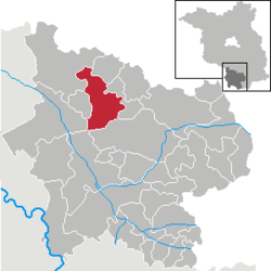 | |
 Schlieben  Schlieben | |
| Coordinates: 51°43′00″N 13°22′59″E / 51.71667°N 13.38306°E | |
| Country | Germany |
| State | Brandenburg |
| District | Elbe-Elster |
| Municipal assoc. | Schlieben |
| Subdivisions | 6 Ortsteile |
| Government | |
| • Mayor (2024–29) | Cornelia Schülzchen[1] (CDU) |
| Area | |
• Total | 78.65 km2 (30.37 sq mi) |
| Elevation | 89 m (292 ft) |
| Population (2023-12-31)[2] | |
• Total | 2,356 |
| • Density | 30/km2 (78/sq mi) |
| Time zone | UTC+01:00 (CET) |
| • Summer (DST) | UTC+02:00 (CEST) |
| Postal codes | 04936 |
| Dialling codes | 035361 |
| Vehicle registration | EE, FI, LIB |
| Website | www.schlieben.com |
Schlieben (pronounced [ˈʃliːbn̩] ⓘ; Lower Sorbian: Sliwin, pronounced [ˈslʲiwʲin]) is a town in the Elbe-Elster district, in southwestern Brandenburg, Germany. It is situated 22 kilometres (14 mi) north of Bad Liebenwerda. Schlieben was the site of a concentration camp during The Holocaust.[3]
From 1815 to 1944, Schlieben was part of the Prussian Province of Saxony. From 1944 to 1945, it was part of the Province of Halle-Merseburg. From 1952 to 1990, it was part of the Bezirk Cottbus of East Germany.

