Seneca, New Mexico
From Wikipedia, the free encyclopedia
Seneca, New Mexico | |
|---|---|
 Seneca, New Mexico | |
| Coordinates: 36°37′42″N 103°07′36″W / 36.62833°N 103.12667°W | |
| Country | United States |
| State | New Mexico |
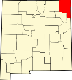
| County | Union |
| Elevation | 4,990 ft (1,520 m) |
| Time zone | UTC-7 (Mountain (MST)) |
| • Summer (DST) | UTC-6 (MDT) |
| Area code | 575 |
| GNIS feature ID | 910940[1] |
Seneca is an unincorporated community in Union County, New Mexico, United States.[1] Seneca is located on New Mexico State Road 406, 12.6 miles (20.3 km) north-northeast of Clayton. Originally known as Cienaga, the name was corrupted by Anglophone settlers after the Civil War. The first postmaster was Flora Blackwell.[2]