Shellytown, Pennsylvania
From Wikipedia, the free encyclopedia
Shellytown, Pennsylvania | |
|---|---|
  Shellytown  Shellytown | |
| Coordinates: 40°24′33″N 78°12′38″W / 40.40917°N 78.21056°W | |
| Country | United States |
| State | Pennsylvania |
| County | Blair |
| Township | Woodbury |
| Area | |
• Total | 0.14 sq mi (0.35 km2) |
| • Land | 0.14 sq mi (0.35 km2) |
| • Water | 0 sq mi (0.0 km2) |
| Elevation | 1,060 ft (320 m) |
| Time zone | UTC-5 (Eastern (EST)) |
| • Summer (DST) | UTC-4 (EDT) |
| ZIP Code | 16693 (Williamsburg) |
| Area codes | 814/582 |
| FIPS code | 42-70032 |
| GNIS feature ID | 2805560[2] |
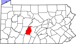
Shellytown is an unincorporated community and census-designated place (CDP) in Blair County, Pennsylvania, United States. It was first listed as a CDP prior to the 2020 census.[2]
The CDP is in eastern Blair County, in the southeastern part of Woodbury Township. It is bordered to the west by Clover Creek, a north-flowing tributary of the Frankstown Branch Juniata River. Clover Creek Road is the main street in the community, leading north 4 miles (6 km) to Williamsburg and southwest 8 miles (13 km) to Fredericksburg.