Tepalcates metro station
Mexico City metro station
From Wikipedia, the free encyclopedia
Tepalcates is a station on the Line A of the Mexico City Metro.[2][3] It is located in the Iztapalapa municipality, to the east of downtown Mexico City.[2] In 2019, the station had an average ridership of 19,326 passengers per day.[4]

 Platform of Tepalcates | |||||||||||||||||||||||||||||||||||||||||||||||||||||||||||||||||||||||||||||||||||||||||||||||||||
| General information | |||||||||||||||||||||||||||||||||||||||||||||||||||||||||||||||||||||||||||||||||||||||||||||||||||
| Location | Iztapalapa Mexico City Mexico | ||||||||||||||||||||||||||||||||||||||||||||||||||||||||||||||||||||||||||||||||||||||||||||||||||
| Coordinates | 19°23′29″N 99°02′47″W | ||||||||||||||||||||||||||||||||||||||||||||||||||||||||||||||||||||||||||||||||||||||||||||||||||
| System | STC rapid transit | ||||||||||||||||||||||||||||||||||||||||||||||||||||||||||||||||||||||||||||||||||||||||||||||||||
| Line | |||||||||||||||||||||||||||||||||||||||||||||||||||||||||||||||||||||||||||||||||||||||||||||||||||
| Platforms | 1 island platform | ||||||||||||||||||||||||||||||||||||||||||||||||||||||||||||||||||||||||||||||||||||||||||||||||||
| Tracks | 2 | ||||||||||||||||||||||||||||||||||||||||||||||||||||||||||||||||||||||||||||||||||||||||||||||||||
| Connections | |||||||||||||||||||||||||||||||||||||||||||||||||||||||||||||||||||||||||||||||||||||||||||||||||||
| Construction | |||||||||||||||||||||||||||||||||||||||||||||||||||||||||||||||||||||||||||||||||||||||||||||||||||
| Structure type | At grade | ||||||||||||||||||||||||||||||||||||||||||||||||||||||||||||||||||||||||||||||||||||||||||||||||||
| History | |||||||||||||||||||||||||||||||||||||||||||||||||||||||||||||||||||||||||||||||||||||||||||||||||||
| Opened | 12 August 1991 | ||||||||||||||||||||||||||||||||||||||||||||||||||||||||||||||||||||||||||||||||||||||||||||||||||
| Passengers | |||||||||||||||||||||||||||||||||||||||||||||||||||||||||||||||||||||||||||||||||||||||||||||||||||
| 2025 | 8,386,963[1][a] | ||||||||||||||||||||||||||||||||||||||||||||||||||||||||||||||||||||||||||||||||||||||||||||||||||
| Rank | 43/195[1][a] | ||||||||||||||||||||||||||||||||||||||||||||||||||||||||||||||||||||||||||||||||||||||||||||||||||
| Services | |||||||||||||||||||||||||||||||||||||||||||||||||||||||||||||||||||||||||||||||||||||||||||||||||||
| |||||||||||||||||||||||||||||||||||||||||||||||||||||||||||||||||||||||||||||||||||||||||||||||||||
| |||||||||||||||||||||||||||||||||||||||||||||||||||||||||||||||||||||||||||||||||||||||||||||||||||
| |||||||||||||||||||||||||||||||||||||||||||||||||||||||||||||||||||||||||||||||||||||||||||||||||||


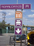
Name and pictogram
The station takes its name from the nearby estate Unidad Habitacional Tepalcates. The name has its roots in the Nahuatl word "teplacatl" used to refer to any pot or vessel made out of clay or mud. The pictogram depicts the side view of a pre-Hispanic pottery bowl of the types made in Puebla and Tlaxcala.[2]
General information
The station was opened on 12 August 1991 along the other nine stations of Line A.[5]
Metro Tepalcates connects with the bus rapid transit stop of the same name of the Mexico City Metrobús Line 2; this stop is the eastern terminus of Line 2.
As every Line A station, except for Pantitlán, it is an at grade station in the median of Calzada Ignacio Zaragoza with the entrances on both sides of the road connecting to the station through two pedestrian bridges. Due to the design of the station, it has an island platform where passengers can take trains in both eastbound and westbound directions.
Ridership
| Annual passenger ridership[a] | |||||
|---|---|---|---|---|---|
| Year | Ridership | Average daily | Rank | % change | Ref. |
| 2025 | 8,386,963 | 22,977 | 43/195 | −10.32% | [1] |
| 2024 | 9,351,995 | 25,551 | 34/195 | +8.53% | [1] |
| 2023 | 8,617,224 | 23,608 | 37/195 | +15.67% | [1] |
| 2022 | 7,449,534 | 20,409 | 41/195 | +39.81% | [1] |
| 2021 | 5,328,315 | 14,598 | 46/195 | +6.88% | [6] |
| 2020 | 4,985,092 | 13,620 | 58/195 | −29.33% | [7] |
| 2019 | 7,054,067 | 19,326 | 92/195 | +11.71% | [4] |
| 2018 | 6,314,510 | 17,300 | 104/195 | +22.80% | [8] |
| 2017 | 5,142,008 | 14,087 | 122/195 | −17.62% | [9] |
| 2016 | 6,241,923 | 17,054 | 107/195 | +4.85% | [10] |
Exits
- North: Calzada Ignacio Zaragoza and General Esteban Baca Calderón street, Colonia Juan Escutia
- South: Calzada Ignacio Zaragoza and Avenida Telecomunicaciones, Unidad Habitacional Tepalcates
Station layout
| G | Street Level | Exits/Entrances |
| G Platforms |
Westbound | ← |
| Island platform, doors will open on the left | ||
| Eastbound | | |
Gallery
 Entry sign

Notes
- The data here is limited to the most recent ten years to avoid excessive listings; earlier figures can be found in this page's history or on the Mexico City Metro website. To calculate the average daily ridership, the annual total is divided by 365 days (366 in leap years), with decimals omitted from the result. Each station per line is ranked individually, as the system counts transfer stations separately. The percentage change is calculated automatically using the data from the current year and the previous year.