Thornwood, West Virginia
From Wikipedia, the free encyclopedia
Thornwood, West Virginia | |
|---|---|
 Thornwood, West Virginia  Thornwood, West Virginia | |
| Coordinates: 38°33′30″N 79°44′13″W / 38.55833°N 79.73694°W | |
| Country | United States |
| State | West Virginia |
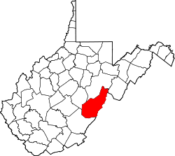
| County | Pocahontas |
| Incorporated | 1912[1] |
| Elevation | 2,884 ft (879 m) |
| Time zone | UTC-5 (Eastern (EST)) |
| • Summer (DST) | UTC-4 (EDT) |
| Area codes | 304 & 681 |
| GNIS feature ID | 1555805[2] |
Thornwood is an unincorporated community in Pocahontas County, West Virginia, United States.[2] Thornwood is on the East Fork of the Greenbrier River. US Route 250 passes approximately one-half mile to the south. It is approximately 5 miles (8.0 km) east-northeast of Durbin.[3]
Thornwood was incorporated in 1912.[1]