Troy (CDP), New Hampshire
From Wikipedia, the free encyclopedia
Troy, New Hampshire | |
|---|---|
 Chandler & Co. | |
  Troy  Troy | |
| Coordinates: 42°49′33″N 72°10′58″W / 42.82583°N 72.18278°W | |
| Country | United States |
| State | New Hampshire |
| County | Cheshire |
| Town | Troy |
| Area | |
• Total | 1.27 sq mi (3.30 km2) |
| • Land | 1.27 sq mi (3.30 km2) |
| • Water | 0 sq mi (0.00 km2) |
| Elevation | 1,007 ft (307 m) |
| Population (2020) | |
• Total | 1,108 |
| • Density | 868.5/sq mi (335.34/km2) |
| Time zone | UTC-5 (Eastern (EST)) |
| • Summer (DST) | UTC-4 (EDT) |
| ZIP code | 03465 |
| Area code | 603 |
| FIPS code | 33-77300 |
| GNIS feature ID | 2629742[2] |
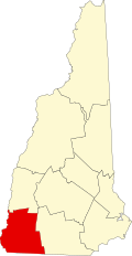
Troy is a census-designated place (CDP) and the main village in the town of Troy in Cheshire County, New Hampshire, United States. The population of the CDP was 1,108 at the 2020 census,[3] compared to 2,130 in the entire town. The center of the CDP is the Troy Village Historic District.