Wachenroth
From Wikipedia, the free encyclopedia
Wachenroth | |
|---|---|
 Weingartsgreuth Castle | |
 Coat of arms | |
Location of Wachenroth
within Erlangen-Höchstadt district 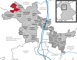 | |
 Location of Wachenroth | |
 Wachenroth  Wachenroth | |
| Coordinates: 49°45′N 10°43′E / 49.750°N 10.717°E | |
| Country | Germany |
| State | Bavaria |
| Admin. region | Mittelfranken |
| District | Erlangen-Höchstadt |
| Subdivisions | 9 districts |
| Government | |
| • Mayor (2023–29) | Reiner Braun[1] |
| Area | |
• Total | 23.16 km2 (8.94 sq mi) |
| Elevation | 285 m (935 ft) |
| Population (2024-12-31)[2] | |
• Total | 2,289 |
| • Density | 98.83/km2 (256.0/sq mi) |
| Time zone | UTC+01:00 (CET) |
| • Summer (DST) | UTC+02:00 (CEST) |
| Postal codes | 96193 |
| Dialling codes | 09548 |
| Vehicle registration | ERH |
| Website | www.wachenroth.de |
Wachenroth is a municipality in the district of Erlangen-Höchstadt, in Bavaria, Germany.
Division of the town
Wachenroth is situated in the valley of the Reiche Ebrach river, a left tributary of the Regnitz river, at the southern end of the Steigerwald, approx. 20 kilometers northwest of Erlangen.
- Buchfeld
- Warmersdorf
- Weingartsgreuth
- Horbach
- Reumannswind
- Volkersdorf
- Oberalbach
- Unteralbach
- Eckartsmühle
History
- 1008 Earliest known documentary mention
- 1434 Wachenroth receives the market rights
- 1978 Incorporation of Weingartsgreuth with Buchfeld, Horbach and Warmersdorf
