Wolcott (CDP), Vermont
From Wikipedia, the free encyclopedia
Wolcott, Vermont | |
|---|---|
 Wolcott Location in Vermont  Wolcott Location in the United States | |
| Coordinates: 44°32′48″N 72°27′28″W / 44.54667°N 72.45778°W | |
| Country | United States |
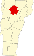
| State | Vermont |
| County | Lamoille |
| Town | Wolcott |
| Area | |
• Total | 0.93 sq mi (2.41 km2) |
| • Land | 0.89 sq mi (2.31 km2) |
| • Water | 0.039 sq mi (0.10 km2) |
| Elevation | 699 ft (213 m) |
| Time zone | UTC−5 (Eastern (EST)) |
| • Summer (DST) | UTC−4 (EDT) |
| ZIP Code | 05680 |
| Area code | 802 |
| FIPS code | 50-85300[1] |
| GNIS feature ID | 2805711[2] |
Wolcott is a census-designated place (CDP) comprising the central community in the town of Wolcott, Lamoille County, Vermont, United States. The CDP was first drawn for the 2020 census.