Zschorlau
From Wikipedia, the free encyclopedia
Zschorlau | |
|---|---|
 Coat of arms | |
Location of Zschorlau within Erzgebirgskreis district 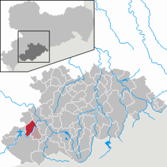 | |
 Zschorlau  Zschorlau | |
| Coordinates: 50°34′N 12°39′E / 50.567°N 12.650°E | |
| Country | Germany |
| State | Saxony |
| District | Erzgebirgskreis |
| Subdivisions | 3 |
| Government | |
| • Mayor (2022–29) | Wolfgang Leonhardt[1] (CDU) |
| Area | |
• Total | 21.99 km2 (8.49 sq mi) |
| Elevation | 548 m (1,798 ft) |
| Population (2022-12-31)[2] | |
• Total | 5,166 |
| • Density | 230/km2 (610/sq mi) |
| Time zone | UTC+01:00 (CET) |
| • Summer (DST) | UTC+02:00 (CEST) |
| Postal codes | 08321 |
| Dialling codes | 03771 |
| Vehicle registration | ERZ, ANA, ASZ, AU, MAB, MEK, STL, SZB, ZP |
| Website | www.zschorlau.de |
Zschorlau (German pronunciation: [ˈt͡ʃɔʁlaʊ]) is a community in the district of Erzgebirgskreis in Saxony, Germany.
Location
Zschorlau lies nestled in the gentle hills in the western Ore Mountains some 5 km from Aue and is overhung in the south by the Steinberg. The community, as is so with many former forest homestead villages (Waldhufendörfer) in the Ore Mountains, grew up on a stream, in this case the Zschorlaubach, which rises southwest of the community on a broad moory plateau known in the local speech as Dr Forst or Hoher Forst (“The Forest” or “High Forest”). Before the stream reaches the community, its waters feed the Filzteich (pond), a popular recreation area. At the end of the community’s area at the Gößnitzgrund comes a glen through which the Zschorlauer Talstraße (Zschorlau Valley Road) was built in 1907. Also in this glen is found the St. Anna am Freudenstein visitor mine.
Geology
The community lies on the southeast flank of the Schneeberger Lagerstätte (deposit), which reaches to the edge of the community. This is made clear by the headframe of the Türkschacht (mine) standing on a bank only a few metres behind the houses between Zschorlau and Neustädtel.
One thing that sets the St. Anna am Freudenstein visitor mine area apart is that it belongs geologically to the Schneeberger Lagerstätte, but is also considered an outlying part of that deposit.
Furthermore, the wolframite deposits discovered and mined in the municipal area are interesting.
Constituent communities
The centres of Albernau (with Schindlerswerk) and Burkhardtsgrün are parts of Zschorlau, which together with neighbouring Bockau forms an administrative community (Verwaltungsgemeinschaft).
History
From 1952 to 1990, Zschorlau was part of the Bezirk Karl-Marx-Stadt of East Germany.
Politics
Municipal council
Zschorlau’s council consists of 16 seats, 15 of which are held by the CDU and the other by the Albernauer Alternative.
Partnerships
There is a partnership with the community of Dietenhofen in the district of Ansbach.